
Category:Georgia State Route 111
 | number: | (one eleven) |
|---|---|---|
| State highways in Georgia (U.S. state): | 91 · 92 · 93 · 94 · 96 · 97 · 99 · 100 · 101 · 102 · 103 · 104 · 105 · 107 · 108 · 109 · 110 · 111 · 112 · 113 · 114 · 115 · 116 · 117 · 119 · 120 · 121 · 122 · 124 · 125 · 126 · 127 · 128 · 129 · 130 |
English: State Route 111 (SR 111) is a state highway in the southwest part of the U.S. state of Georgia. The highway runs from the Florida state line, southwest of Calvary northeast through Cairo and Meigs, glancing off the northwest corner of Riverside, and ending in Moultrie.
highway in Georgia  | |||||
| Upload media | |||||
| Instance of | |||||
|---|---|---|---|---|---|
| Location | Georgia | ||||
| Transport network | |||||
| Owned by | |||||
| Maintained by | |||||
| Length |
| ||||
| |||||
Subcategories
This category has the following 5 subcategories, out of 5 total.
Media in category "Georgia State Route 111"
The following 8 files are in this category, out of 8 total.
-
%2C_Cairo.JPG/120px-Ameris_Bank_(West_face)%2C_Cairo.JPG) Ameris Bank (West face), Cairo.JPG 4,320 × 3,240; 4.46 MB
Ameris Bank (West face), Cairo.JPG 4,320 × 3,240; 4.46 MB
-
 Cairo RR Crossing Georgia State Route 111.JPG 3,072 × 2,304; 3.12 MB
-
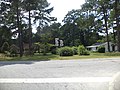
 Drive through, Meigs.JPG 4,320 × 3,240; 4.53 MB
-
 GA 93 111 connector, Grady County.JPG 4,320 × 3,240; 4.49 MB
-
 Georgia 111.svg 750 × 600; 3 KB
-
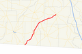 Georgia state route 111 map.png 597 × 399; 57 KB
-
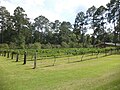 Grape vines, Meigs.JPG 4,320 × 3,240; 4.49 MB
-
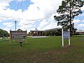 Hamilton Elementary School, Colquitt County.JPG 5,152 × 3,864; 7.83 MB
,_Cairo.JPG)


