
Category:Georgia State Route 16
 | number: | (sixteen) |
|---|---|---|
| State highways in Georgia (U.S. state): | 1 · 2 · 3 · 4 · 5 · 6 · 7 · 8 · 9 · 10 · 11 · 12 · 13 · 14 · 15 · 16 · 17 · 18 · 19 · 20 · 21 · 22 · 23 · 24 · 25 · 26 · 27 · 28 · 29 · 30 · 31 · 32 · 33 · 34 · 35 · 36 |
State highway in central Georgia   | |||||
| Upload media | |||||
| Instance of | |||||
|---|---|---|---|---|---|
| Location | Georgia | ||||
| Transport network | |||||
| Owned by | |||||
| Maintained by | |||||
| Inception |
| ||||
| Length |
| ||||
| |||||
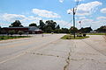
English: State Route 16 (SR 16) is a state highway that runs west-to-east through portions of Haralson, Carroll, Coweta, Spalding, Butts, Jasper, Putnam, Hancock, and Warren counties in western and central Georgia. The route runs from its western terminus at SR 100 northwest of Mount Zion to its eastern terminus at US 278 and SR 12 in Warrenton.
Subcategories
This category has the following 5 subcategories, out of 5 total.
Media in category "Georgia State Route 16"
The following 8 files are in this category, out of 8 total.
-
 Georgia 16 Connector.svg 600 × 600; 10 KB
-
 Georgia 16 Spur.svg 600 × 600; 12 KB
-
 GA State Route 16, Mount Zion, Georgia.JPG 3,456 × 2,304; 3.98 MB
-
.jpg/120px-GA34wRoad-US27A-GA16wGA14US29GA34bypSigns_(28598010525).jpg) GA34wRoad-US27A-GA16wGA14US29GA34bypSigns (28598010525).jpg 1,200 × 800; 543 KB
GA34wRoad-US27A-GA16wGA14US29GA34bypSigns (28598010525).jpg 1,200 × 800; 543 KB
-
.jpg/120px-GA34wRoad-US27AnsUS29nsGA14nsGA16ewOverheads_(28491164492).jpg) GA34wRoad-US27AnsUS29nsGA14nsGA16ewOverheads (28491164492).jpg 1,200 × 800; 588 KB
GA34wRoad-US27AnsUS29nsGA14nsGA16ewOverheads (28491164492).jpg 1,200 × 800; 588 KB
-
 Georgia 16.svg 600 × 600; 5 KB
-
 Georgia state route 16 map.png 1,134 × 591; 242 KB
-
 Putnam County Courthouse - panoramio.jpg 3,008 × 2,000; 6.25 MB


.jpg)
.jpg)
