
Category:Georgia State Route 89
 | number: | (eighty-nine) |
|---|---|---|
| State highways in Georgia (U.S. state): | 70 · 72 · 73 · 74 · 75 · 76 · 77 · 79 · 81 · 82 · 83 · 85 · 87 · 89 · 90 · 91 · 92 · 93 · 94 · 96 · 97 · 99 · 100 · 101 · 102 · 103 · 104 · 105 · 107 · 108 · 109 |
English: State Route 89 is a state highway in Georgia. The route is concurrent with U.S. Route 441 for its whole length.
Subcategories
This category has only the following subcategory.
G
Media in category "Georgia State Route 89"
The following 19 files are in this category, out of 19 total.
-
 Building on stilts next to Suwannee River, Fargo.JPG 4,320 × 3,240; 4.54 MB
-
 Cassia Lodge, Homerville Masonic Building.JPG 4,320 × 3,240; 4.46 MB
-
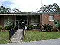
 ClinchCoRecDept.jpg 3,072 × 2,304; 1.11 MB
-
 Fargo limit, US441 SB.JPG 4,320 × 3,240; 4.5 MB
-
 Fargo water tower, US441.JPG 4,320 × 3,240; 4.46 MB
-
 Fargo welcome, US441 NB.JPG 4,320 × 3,240; 4.6 MB
-
 FargoCharterSchool.jpg 3,072 × 2,304; 2.03 MB
-
 FargoCityHall.jpg 3,072 × 2,304; 1.47 MB
-
 GA122 US441 intersection, Clinch County.jpg 5,184 × 3,456; 5.57 MB
-
 GA177 end, Clinch County.JPG 4,320 × 3,240; 4.49 MB
-
 GA94WB, Clinch County GA89 US441 left.jpg 5,184 × 3,456; 4.43 MB
-
 Georgia 89.svg 600 × 600; 6 KB
-
 Georgia Forestry Commission Tower, Homerville.JPG 4,320 × 3,240; 4.42 MB
-
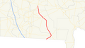 Georgia state route 89 map.png 759 × 429; 69 KB
-
 Homerville Congregational Methodist Church.JPG 4,320 × 3,240; 4.55 MB
-
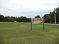
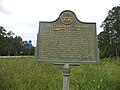 Okefenokee Swamp historical marker, Fargo.JPG 4,320 × 3,240; 4.54 MB
-
 Rite Aid, Homerville.JPG 4,320 × 3,240; 4.46 MB
-
 SuwaneeRiverVisitorsCenter.jpg 3,072 × 2,304; 1.19 MB
-
 Suwannee River boat ramp, Fargo.JPG 4,320 × 3,240; 4.51 MB


